Maps help us navigate and find our way when we are lost or don’t know where we are going. However, each map serves a different purpose. The variety allows us to track the weather, navigate, find out information about an area, etc.
Physical maps illustrate the shape of the land (in terms of terrain) – hills, lakes, forests, streams, rivers, beaches, the coast and so on. Political maps show how we (as humans) use the land – counties, provinces, countries, town boundaries, etc.
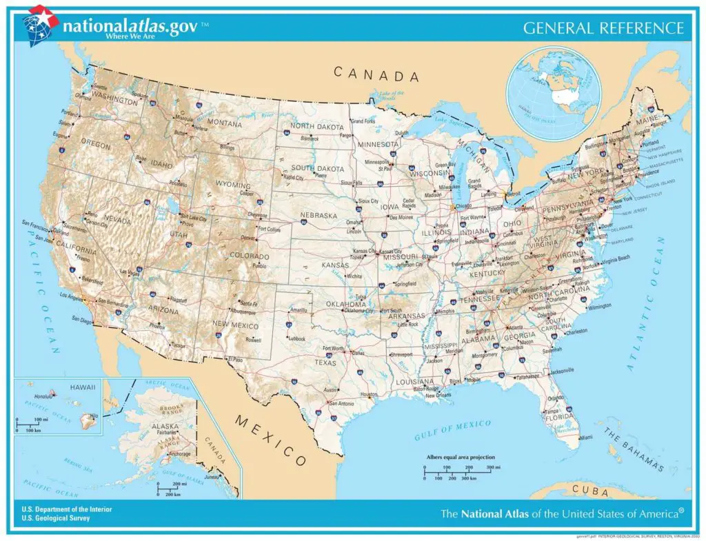
General Reference
This is a regular map. Its main purpose is to name cities and towns, as well as major transport routes, natural features like lakes and rivers, etc.
These are the maps that help you find your way to your destination. They are easy to read and include street and tourist maps. A good example is, perhaps even the best example, HERE maps.
Topographical
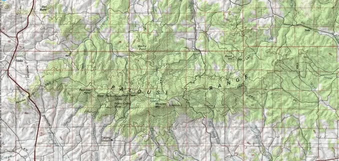
Topographical maps show detailed elevation, including contour lines that help to map the landscape. Ordnance Survey maps are the best examples of topographical maps. These maps may look challenging to understand but they are quite easy to read.
Thematic
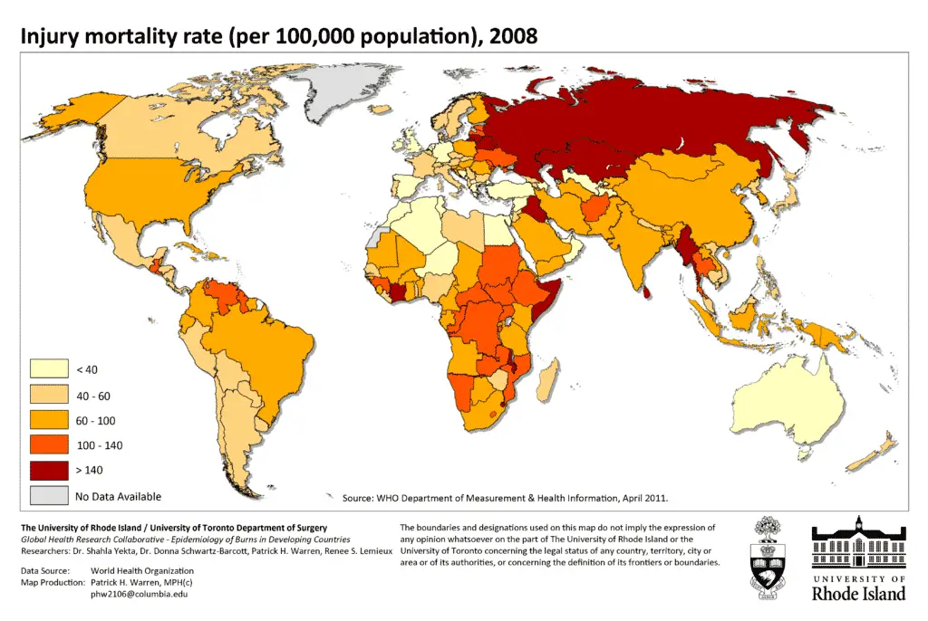
Thematic maps highlight information on precise topics. For example, it could be a map of anything from geology to population density or even the weather.
Thematic maps are so versatile that there’s even one used to track the locations of whales. Unlike general reference maps, which are easily read and understood by most persons, thematic maps may also need specific knowledge before you are able to understand what the map is about.
Weather Maps
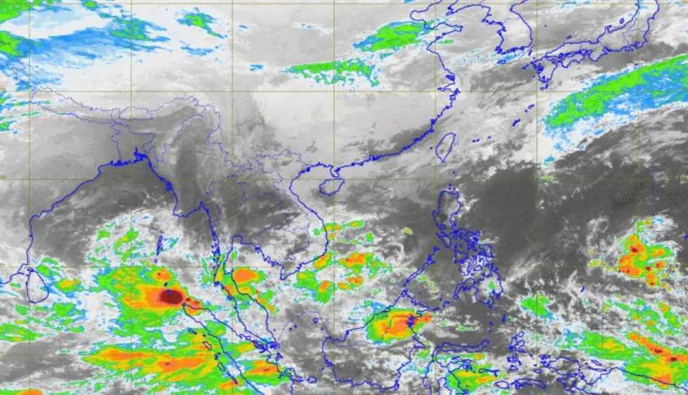
Weather maps are also thematic maps. The main purpose of a weather map is to show temperature, wind direction, and speed, storm warnings, frost predictions, snow accumulation, the chance of precipitation, types of precipitation, etc.
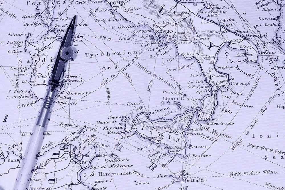
Navigational charts are another valuable tool when it comes to finding your way around. It can be by sea or by air. Maps for the ocean and air navigation are generally referred to as charts (we use different types of telescopes to map the stars and the universe).
These charts normally include information that’s important to avoid accidents – such as features in and around the water, like submerged rocks, volcanoes, glaciers, etc. – along with any other specific navigational aids.
Cadastral Maps and Plans
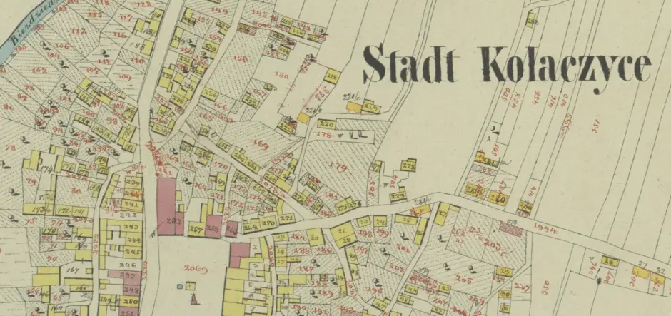
Plans map out individual properties, giving details like boundary information when houses or land are surveyed. Plans can be joined together to create much larger cadastral maps. If you ever get a house surveyed, you may see a cadastral map being used.